
One platform.
The entire operation.
Nexa M1 and Nexa Vision run on the Convex web platform and mobile app. The rest of the lineup supports operation, mission and data collection.
Convex / 2026
ECOSYSTEM / PRODUCTSWhat runs on the platform.
Nexa M1 and Nexa Vision are the platform's products. Synapse Control, Axis and Atmos support operations and feed the analysis.
Nexa M1
Interprets data and generates diagnosis, recommendation and report.
Nexa Vision
Analyzes imagery and spectral indices, mapping the area layer by layer.
Synapse Control · Axis · Atmos
Plan the mission, execute in the field and feed the platform with data.
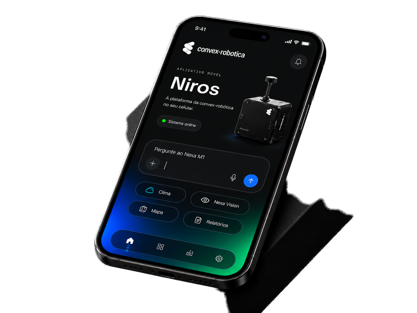
The Convex platform also goes with you into the field.
Access monitored areas, weather, alerts, reports, and operational routines directly from the Convex mobile app. The web platform and the app share the same data: whatever is analysed in the browser is available in the app.
- Reports
- Maps, indices and PDF reports available in the browser and in the app.
- Weather
- Real-time conditions, forecast and history for the monitored area.
- Alerts
- Operational warnings for cold, heavy rain, wind and storms.
- Management
- Monitored areas, delivery frequency and operational routines.
Nexa M1
The platform's intelligence.
Turns raw data into objective diagnosis, with recommendation and technical report.
- Multimodal analysis of imagery, sensor and satellite data
- Anomaly and hotspot detection
- Temporal comparison between collections
- Technical reports in PDF
Nexa Vision
Applied computer vision.
Reads imagery and spectral indices to show where the area is healthy and where it isn't.
- RGB maps and spectral indices per layer
- Severity and hotspots by region
- Area evolution between dates
- Visual report with maps and charts
NDVI
NIR
AI
Operational support.
Mission, field execution and data collection — the base that feeds the platform.
Synapse Control
Plans routes, tracks live telemetry and keeps the mission history.
View Synapse Control →Axis
Autonomous robot that covers the area, collects up close and runs repetitive routines.
View Axis →Atmos
Portable weather station that sends local climate data straight to the platform.
View Atmos →Multiple data sources.
All converging into the same dashboard.
RGB imagery
High-resolution visual record.
Multispectral
Bands beyond the visible spectrum.
Thermal
Temperature variation.
Satellite
Recurring coverage of large areas.
Weather stations
Current weather, forecast and history.
IoT sensors
Soil, moisture and continuous variables.
Robot telemetry
Position, status and mission data collection.
Property data
Fields, lots and registration records.
Platform capabilities.
Everything inside the dashboard.
RGB maps
Accurate view of the area.
Spectral indices
Layers by analysis type.
Anomalies
Zones outside the pattern.
Hotspots
Concentration of severity.
Temporal comparison
Evolution between dates.
Alerts
Notification when a threshold is crossed.
Recommendations
Next step per area.
Technical reports
PDF with maps and charts.
History
Analyses by property.
Missions
Real-time status and telemetry.
How it works.
Four steps, from registration to report.
Registration
Property, fields and lots.
Area
Draw on the map or upload the capture.
Processing
The AI computes, compares and diagnoses.
Delivery
Maps, recommendations and report on the dashboard.
Sectors served.
The same analytical base, adapted to each operation.
Agriculture
Vigor per field, water stress and planting failures.
Livestock
Pasture, behavior and thermal monitoring.
Poultry
Thermal reading and barn uniformity.
Swine
Ambient conditions and inspection routine.
Aquaculture
Tank surface and history per batch.
Industrial operations
Asset inspection and automated rounds.
What you get.
Start with the analysis and expand as the operation requires.
Nexa M1
Analysis and diagnosis.
- Satellite analysis
- Diagnosis and recommendations
- PDF report
- History
Nexa M1 + Nexa Vision
Analysis with full visual reading.
- Everything in Nexa M1
- Maps and spectral indices
- Hotspots and severity
- Temporal comparison
Platform + field support
With mission, execution and own data collection.
- Everything in the platform
- Missions in Synapse Control
- Execution with Axis
- Local data from Atmos
Integrations and infrastructure.
Built to coexist with what's already in place.
Integrations and API
Connection to the systems already in use.
Secure storage
Per-client data isolation.
Access control
Permissions by user and property.
Data history
Analyses preserved for comparison.
Machine connectivity
In development.
Drones and stations
In development.
Frequently asked questions.
Do I need a drone or a robot?
No. Satellite analysis works with just the area on the map.
How long does an analysis take?
Minutes. The report appears on the dashboard right after.
Is the data stored?
Yes, in the property's history, with temporal comparison.
Can it integrate with my systems?
Yes, via API.
Does it work outside agriculture?
Yes: livestock, poultry, swine, aquaculture and industry.
How does a pilot start?
We define the area, objective and monitoring period together.